Lake Washington, August 2026
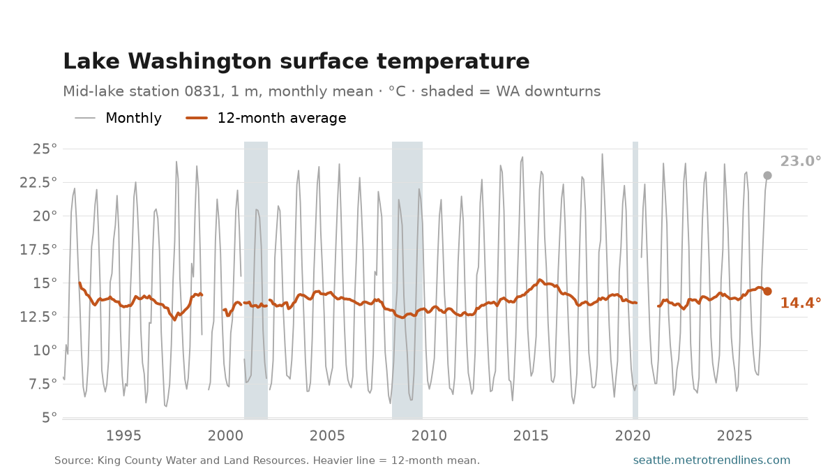
Lake Washington’s surface was 23.0°C (73°F) in August 2026, at King County’s station in the middle of the lake south of the I-90 bridge. The August average since 1992 is 22.2°C; the warmest August was 24.4°C, in 2014.
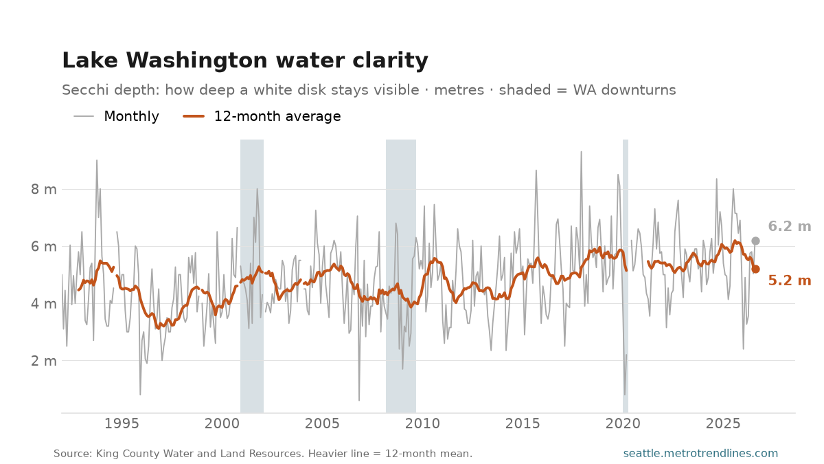
Clarity. A white disk lowered into the lake stayed visible to 6.2 metres in August 2026, against 7.2 metres a year earlier. Over the last twelve months it averaged 5.2 metres; in the first twelve months of this record, to November 1992, it averaged 4.5.
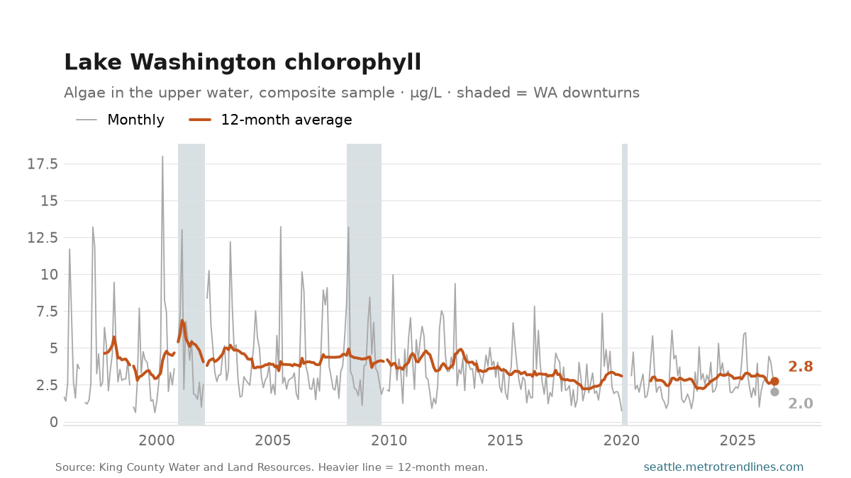
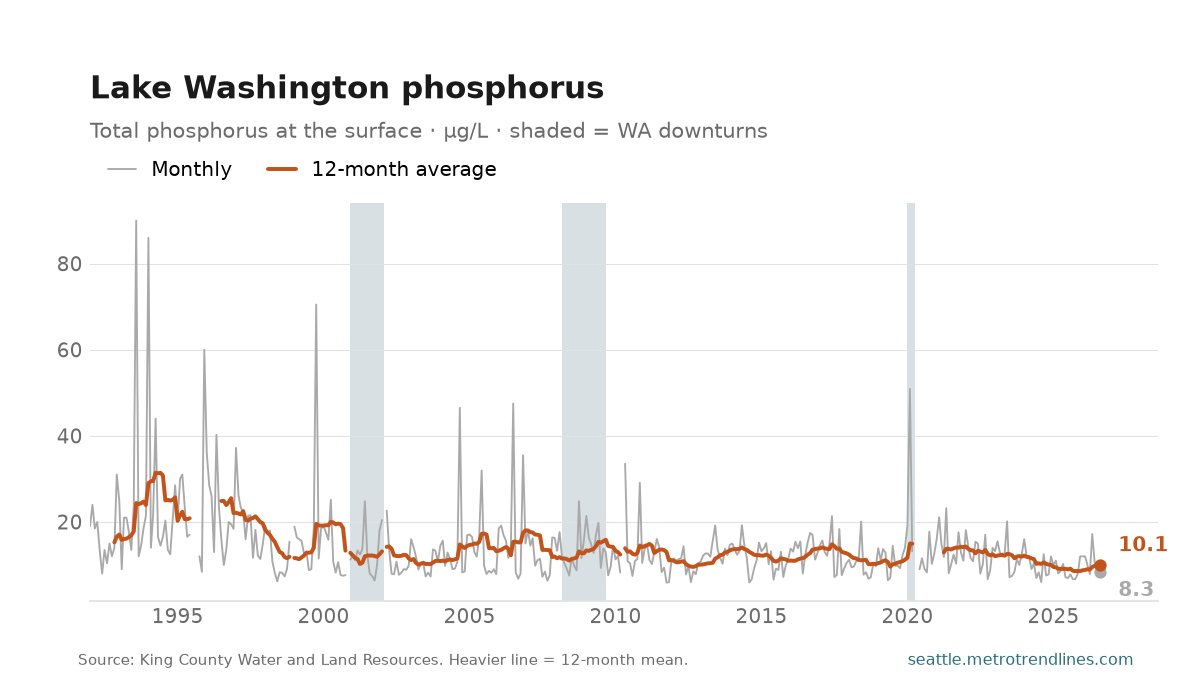
Algae and what feeds them. Chlorophyll, the measure of algae in the upper water, read 2.0 micrograms per litre in August 2026 and has averaged 2.8 over the last year, against 4.6 in the year to October 1997. Phosphorus at the surface has averaged 10.1 micrograms per litre over the last year, against 15.3 in the year to November 1992. Phosphorus is the nutrient that limits algae in this lake, which is why it is on the page.
That is the lake’s history in miniature. In the 1950s and early 1960s treated sewage from a ring of new suburbs ran into Lake Washington, the phosphorus in it fed algae, and the disk vanished at under a metre. Metro diverted the sewage to Puget Sound between 1963 and 1968, and the lake became the textbook recovery. This record starts in 1992, well after it, so what these lines show is what came next.
Each value is the mean of the month’s sampling trips, usually two, at one station. All four series swing with the seasons — the lake is warmest in August, clearest in autumn, and greenest in the spring bloom — so compare a month with the same month in other years, or read the 12-month line. A month with no sampling trip is a gap, not a guess; the station was not sampled at all from 1984 to 1992, which is why the record starts where it does.
Source: King County Water and Land Resources Division, lake water quality data, station 0831; monthly means of each sampling trip, samples flagged questionable or bad excluded. Auto-generated each build.